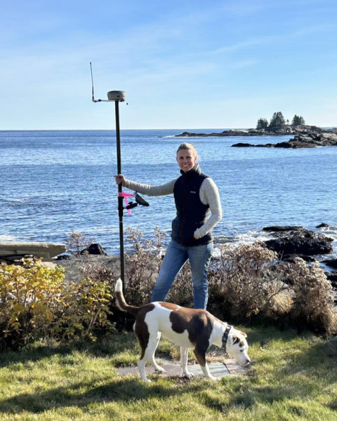
Anne Howell and Scout, of SurveyScapes, on site with survey equipment in New Harbor. Howell and business partner Stephanie Mazerolle described their work as putting together a mathematical puzzle, researching the deed histories of properties and then visiting the site to look for boundary clues. (Courtesy photo)
Anne Howell and Stephanie Mazerolle often find themselves lugging surveying gear up hills and through ravines across the Midcoast, sometimes bushwhacking through brambles in pursuit of a carefully researched colonial rock wall or a remnant of an old barbed wire fence.
Howell, of Camden, and Mazerolle, of Round Pond, are longtime friends and the owner-operators of SurveyScapes LLC, which offers deed research, boundary location, mapping, and landscape designs.
They met while working together at Pinkham’s Plantation in Damariscotta in the early 2000s and stayed in contact as they went on to other things. When Mazerolle mentioned surveying in a conversation about what to do next after years with her own landscaping business, Howell remembered she had tried it in undergrad and enjoyed the experience.
“When I was a kid I wanted to be an archeologist, and there’s aspects of it that are like that. You’re looking for old evidence, and stone walls, and researching,” she said. “We research these back to the creation of a piece of land, so we’re researching deeds back to the 1800s, sometimes 1700s.”
Mazerolle, meanwhile, thought: “I still want to be outside. Whatever I do, I want to still be outside.”
They both went back to school at the University of Maine Orono, completing second bachelor’s degrees in surveying engineering technology in three years.
After graduation in 2015, Mazerolle found a job at Good Deeds, a female-owned surveying company in Belfast. Howell joined her there a year later, and they worked together for the next six years.
Hoping to work closer to where they lived, the pair spent some time at another company before striking out on their own in late 2022 for stronger client relationships and control of their schedules.

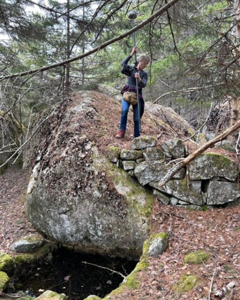
Stephanie Mazerolle examines an old stone wall on Vinalhaven for her work finding property lines with SurveyScapes. Sometimes, she and business partner Anne Howell describe their work as “bushwhacking” in search of clues, but they enjoy the outside experience. (Courtesy photo)
Demand is high for surveyors, they said, especially after the pandemic. Other companies in operation at that time are still booked out a year from pent-up demand. As a newer company, SurveyScapes has room for new clients, and Mazerolle said they always return a phone call.
The two also emphasize client relationships and what they find to be the benefits of operating as women in a male-dominated field. According to the U.S. Bureau of Labor Statistics, 11.3% of surveying and mapping technicians in the country were women in 2022.
“The industry itself tends to be people that don’t necessarily want to be in the public, or communicating all the time in the public,” Mazerolle said. “They really just want to be hiking out in the woods and looking for things … we like both sides a lot.”
The SurveyScapes team finds that their presence as women tends to de-escalate tense situations when property is in dispute, and they find their communication style to be successful too.
“People take their land seriously, you know, and we respect that,” Howell said.
They split the responsibilities equally, each taking the lead on different properties to complete research before going out into the field. Most projects take several weeks to complete, depending on the complexity.
The research includes the history of all neighboring parcels that touch the property to recreate the original division of land when towns were created in 100-acre strips. Constructing a timeline of how the property was divided can be the hardest part, they said.
Maine allows landowners to write their own deeds, which can make the research extra complicated. The specific rules of a reading a deed can be misunderstood, Howell said. For example, a deed might be written using a stone wall as its boundary, but the property line will follow that stone wall even if it is curved or longer than the writer believed.
“Once that’s on a piece of paper and it reads a certain way, we really have kind of strict guidelines we have to follow,” Mazerolle said. That’s the way you wrote it. That’s what it is, whether you really intended that or not.”
Some deeds reference trees or stone walls or fences that may no longer exist, leading to searches for clues. In the rare case no evidence is found, they write up land agreement and create a new deed to describe it.

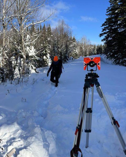
The SurveyScapes team at work in Rangeley in December. The company owned and operated by longtime friends serves all of Maine, though most customers are in the Midcoast. (Courtesy photo)
Howell and Mazerolle described their work as retracing the property lines as they were meant to be constructed, rather than creating new ones or taking land away. The decisions have to be carefully made, too, or the surveyors risk being taken to court.
“I think there’s a misconception that we just go out and we’re like, ‘Here’s your corner,” Howell said.
“It rarely works like that,” Mazerolle said. “It’s a big puzzle.”
Then comes the site work: finding the line in real life carrying tools, GPS units, metal detectors, and shovels.
“I got a stick in my eye before Christmas that was bleeding,” Mazerolle said with a laugh.
“Sometimes I feel like I should wear a GoPro so people understand,” Howell added.
Howell and Mazerolle find the work rewarding despite its physical demands, though they joked they are rarely up for hiking invitations on the weekend. It also shows them unexpected natural beauty in places they thought they knew.
“Even in Bristol, you know, we’ll be out and be like, ‘I cannot believe we’re in the middle of the woods in Bristol,’” Mazerolle said, describing an impressive beaver pond they had come across. “It’s like you’re in the middle of nowhere and it’s just right here, outside your door.”
For more information, find SurveyScapes on Facebook or go to surveyscapes.com.


